

Legacy maps collection
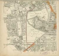 This is the legacy collection of digitised maps. The maps focus mostly on Christchurch and Canterbury.
Many more Maps, plans and drawings can be found in Canterbury Stories, including collections of
The digital copies of the maps are from originals held by Christchurch City Libraries, Christchurch City Archives, and from the Cartographic Collection at the Alexander Turnbull Library, National Library of New Zealand.
