New Zealand earth science and geology
Earth Science is the study of the solid Earth and the water on and within it and the air around it. Earth Science includes Geology which explores the planets natural resources, and monitors natural hazards such as volcanoes and earthquakes
New Zealand has a complex geology and an ongoing active history of earthquakes, landslips and volcanic activity. Te Ara (the Encyclopaedia of New Zealand) gives an excellent overview of New Zealand’s geology.
More information
NZ Earth Science
Earthquakes
New Zealand is positioned on the boundary of the Australian and the Pacific tectonic plates. It is movement in these tectonic plates – huge chunks of the earth’s crust – that cause earthquakes. Earthquakes at sea can cause tsunami.
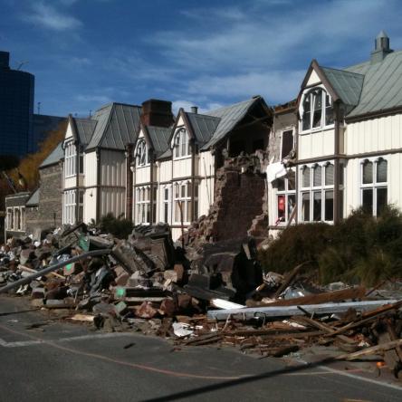
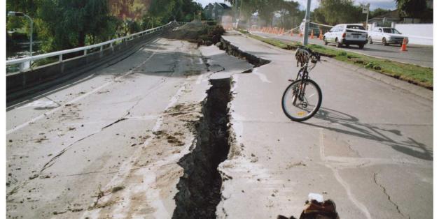
Earthquakes are common in New Zealand though most are not strong enough to be felt. Large earthquakes can be destructive. Recent large, damage-causing earthquakes have happened in Wellington, Kaikōura, Seddon, Christchurch and Darfield.
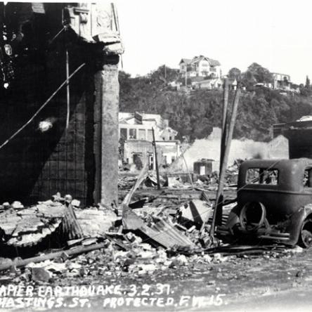
Historically, other significant quakes in New Zealand have happened in Edgecumbe, Inangahua, Hawkes Bay, Murchison and Wellington.
Te Ara - the Encyclopedia of New Zealand has useful information on earthquakes and seismic activity in New Zealand.
Measuring earthquakes
The strength of earthquakes is measured as magnitude on the Richter scale, named after Charles Richter. The Modified Mercalli intensity scale measures the intensity of earthquakes based on what can be felt and observed by people and is considered a better indicator of the effects of an earthquake.
Earthquakes in New Zealand
Between 10,000 and 15,000 earthquakes are recorded in New Zealand annually, and approximately 140 to 150 are large enough to be felt by humans.
New Zealand earthquake data
GeoNet is a collaboration between the Earthquake Commission and GNS Science. It features a map showing near real–time shaking intensity from New Zealand’s network of seismographs.
Find out about the Christchurch and Canterbury earthquakes
Be prepared
Useful websites during emergencies
- Get thru – Civil Defence website
- Civil Defence Emergency Management from the Christchurch City Council. During an emergency follow their Facebook or Twitter accounts to receive updates
- Civil defence meeting points and organisations from CINCH
Earthquakes
Volcanoes
GeoNet maintains a Volcano Watch which lists current volcanic activity.
GNS Science (a Government research institute) has an informative web site about New Zealand volcanoes.
Mount Tongariro, Mount Ruapehu and White Island have all been active relatively recently.
Tongariro
Explore its history of Mount Tongariro eruptions:
- Papers Past articles on previous eruptions.
- Tongariro Story: Historic volcanic activity: Tongariro and Ngāuruhoe in Te Ara: The Encyclopedia of New Zealand.
- A Digital NZ set of images, articles and research on Mount Tongariro.
Historical eruptions
The most famous eruption in recent history was that of Mount Tarawera in 1886 which caused significant loss of life in villages nearby and destroyed the famous Pink and White Terraces.
Further back in time, the Taupō Volcano produced massive eruptions which led to the creation of Lake Taupō.
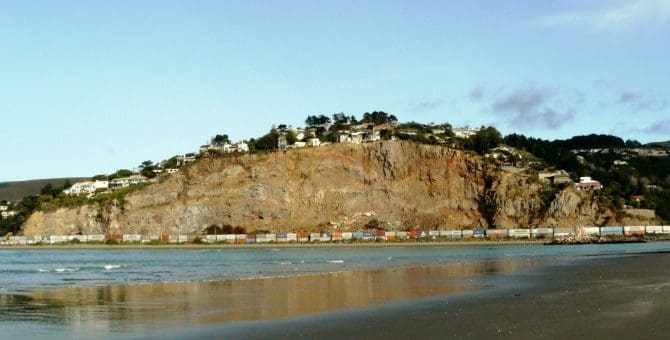
Locally, the Lyttelton and Akaroa harbours of Banks Peninsula were formed around 6000 years ago when the calderas of these extinct volcanoes filled with sea water.

Volcanoes
Lahars
A lahar is a violent mudflow, a mix of water and rocky debris that flows down from a volcano. They can be extremely destructive as large volumes of mud and debris can travel at high speed. A lahar from Mount Ruapehu was responsible for damaging a rail bridge over the Whangaehu River in 1953 causing the Tangiwai railway disaster that killed 151 people.
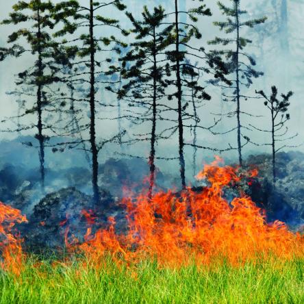
Landslides
Landslides have happened regularly throughout New Zealand’s geological history. Perhaps the most dramatic slip was the collapse of part of the east face of our highest mountain, Aoraki/Mount Cook, on 14 December 1991. The peak was shortened by 10 metres.
In 1979, a massive slip in the Dunedin suburb of Abbotsford caused 70 houses to be destroyed or relocated.