Inner city report, 1946 / Arthur Francis Stacey
Click on image to view thumbnails ~ About this collection ~ Related Material
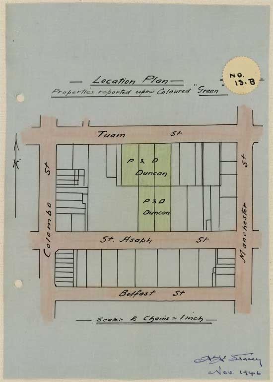
No. 13B. Location plan to scale showing locations Lichfield Street and Tuam Street : Image 17 of 35
- Title No. 13B. Location plan to scale showing locations Lichfield Street and Tuam Street coloured green.
- Creator Arthur Francis Stacey
- Date 1946
- Image 17 of 35
- Physical Description 21.5cm x 32.5cm
- Notes No. 13B. Location plan to scale showing locations Lichfield Street and Tuam Street coloured green which will be reported upon hereinafter.
- Source Christchurch City Council Heritage files
- Collection Location Christchurch City Council Archives
- File Reference CCC-AFStacey-017
- View PDF of this page [125 Kb]
Click on image to view thumbnails ~ About this collection ~ Related Material
Reproduction:
This image is provided for research purposes only and must not be reproduced without the permission of the Archivist, Christchurch City Council Archives. Contact them.
Copyright and other restrictions
This material has been provided for private study purposes (such as school projects, family and local history research) and any published reproduction (print or electronic) may infringe copyright law. Please contact Christchurch City Libraries if you have any questions relating to the use of this material. It is the responsibility of the user to obtain clearance from the copyright holder.


