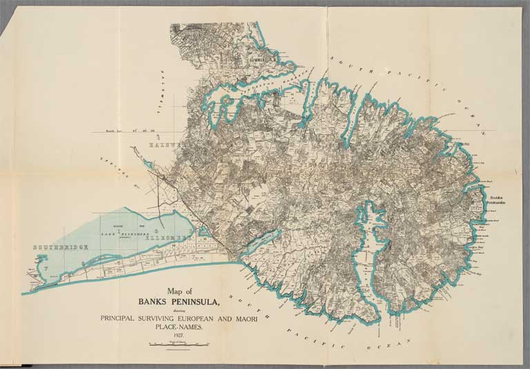
Map of Banks Peninsula showing ... European and Maori place-names
Title: Map of Banks Peninsula showing principal surviving European and Maori place-names
Date: 1927
Physical Description: 38 x 54 cm; From: Place-names of Banks Peninsula / Johnannes C. Andersen. Govt. Print, 1927
Scale etc: Scale [ca. 1:126,720].
Notes: From: Place-names of Banks Peninsula : a topographical history / by Johannes C. Andersen. Wellington [N.Z.] : Govt. Printer, 1927.
File Reference: CCLMaps 536127
View enlargable version (with Zoomify)
View further details (catalogue record)
Click on image to view thumbnails ~ Title index ~ Digital Maps homepage
Copyright status of this item:
To the best of our knowledge the image is free of copyright, but legal opinion should be sought to establish certainty before publishing the image in any way or using it for commercial purposes.
Copyright and other restrictions
This material has been provided for private study purposes (such as school projects, family and local history research) and any published reproduction (print or electronic) may infringe copyright law. Please contact Christchurch City Libraries if you have any questions relating to the use of this material. It is the responsibility of the user to obtain clearance from the copyright holder.


 Discover your family’s history at our libraries
