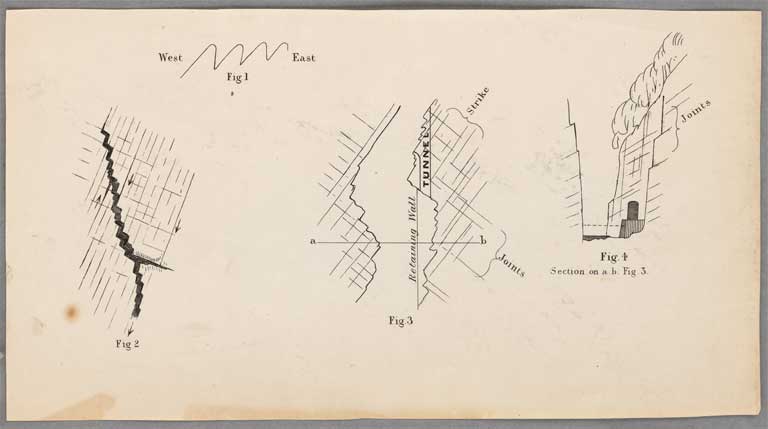
Miscellaneous diagrams, Figs 1-4
Title: Miscellaneous diagrams, Figs 1-4
Date: 1865
Multipart Note: Fig. 1
Physical Description: A4
Scale etc: Scales vary
Notes: [Diagram illustrating the folding of the strata at the head of the Waimakariri Valley]; Fig. 2. Sketch plan shewing the manner in which the Bealey and other rivers run alternately on the lines of strike and cross jointing]; Fig. 3 and 4. Plan and section illustrating the system to be adopted in constructing a road through the gorge of the Otira]
File Reference: CCLMaps 543242-02
View enlargable version (with Zoomify)
View further details (catalogue record)
Click on image to view thumbnails ~ Title index ~ Digital Maps homepage
Copyright status of this item:
We believe the image is free of copyright. If you have information to the contrary, please let us know.
Copyright and other restrictions
This material has been provided for private study purposes (such as school projects, family and local history research) and any published reproduction (print or electronic) may infringe copyright law. Please contact Christchurch City Libraries if you have any questions relating to the use of this material. It is the responsibility of the user to obtain clearance from the copyright holder.


 Discover your family’s history at our libraries
